----- ----- ----- ----- ----- ----- ----- ----- -----
◎国内外の友人へ一言近況「板倉区針への道中スナップ」:
Yoshy’s Brief Updates to my Friends at Home and Abroad “Snaps on the way to Hari, Itakura Ward”
12月10日(土)は、LL生徒から欠席通知があり、お休み. そこで、寒い曇天でしたが、健康のため、長距離散歩を決行!-2:00 pmに我が家を、上越市板倉区針在住のK君宅に向かって出発. 1時間の予定が、2時間かかってしまいました. Rには5:00 pmまでに帰宅すると言っておいたので…
Last Saturday, December 10th, I received an absence notice from an LL student, so LL School took a day off. ― At 2:00 pm, I left my home and headed for Mr. K's house, who lives in Hari District, Itakura Ward in Joetsu City. I had to return home by 5:00 pm, but …
Here are some photos taken along the way to his house.
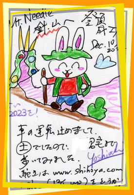
<0a: 上越市板倉区「針山単独登頂成功記念絵葉書」☺、Congratulations on solo-reaching the top of Mt. Needle in Itakura, Joetsu from LL Shihoya Arai School in Myoko City>
<0b: 栄町、西方向:Sakae-cho St. Toward west.>
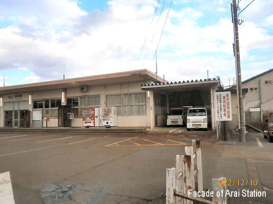
<0c: 新井駅:Arai Train St.>
<0d: Ditto>
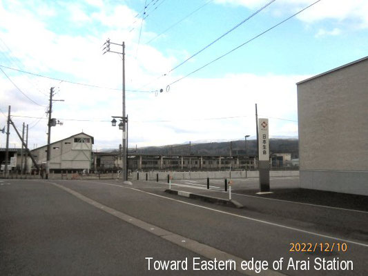
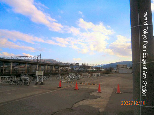
<0e: 新井駅より東京方向:Toward Tokyo from Arai St.>
<0f: 新井駅より朝日町東端:Eastern edge of Asahi-cho Street from Arai St.>
<0g: 新井駅北端より三村屋旅館方向:Toward Mimura-ya Inn from the northern edge of Arai St.>
<0h: 新井駅橋梁(きょうりょう)より西方向、元平出外科医院跡地:Toward the site of ex-Hiraide Surgical Hospital from the Bridge of Arai St located at the edge to the north.>
<0i: 新井駅東側通り:East Lane of Arai St toward south.>
<0j: 新井駅橋梁(きょうりょう)東側:East side of the bridge of Arai St.>
<0k: 諏訪町東端交差点、ダイセル化学工場・旧屋外運動場跡地:Ex-Outdoor Gym of Daiseru Chemical Plants Co. Ltd taken at the crossing of the stating area of Suwa-cho.>
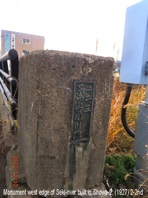
<0L: 関川橋西端の石碑、「ニ、二、二 東雲町関川線」Stone Monument at the western edge of Seki-river, written “Build on Feb 2nd, Showa 2 (1927), Shinonome-cho Sekikawa Line”>
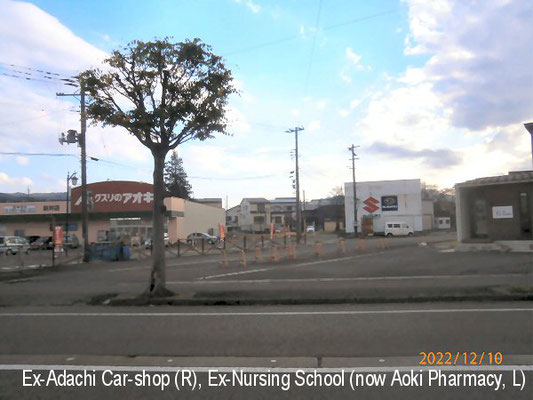
<0m: 諏訪町通り南側、元安達自動車跡地、第一保育園跡地にアオキ薬局が: The southern side of Suwa-cho St. The site of ex-Adachi Car shop and the one of The First Nursery School, now Aoki Pharmacy.>
<0n: 国道交差点、柿崎方向:Toward Kakizaki Line at the crossing of two National Roads from Suwacho Street.>
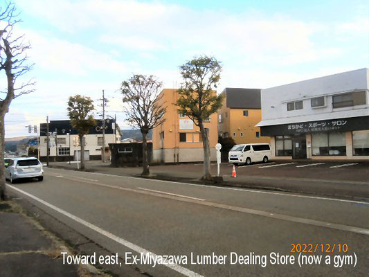
<0o: 元宮澤材木店跡地、現在民間のスポーツジム:The site of ex-Miyazawa Lumber Dealing Store, now a nonofficial sport-gym at Suwacho Street.>
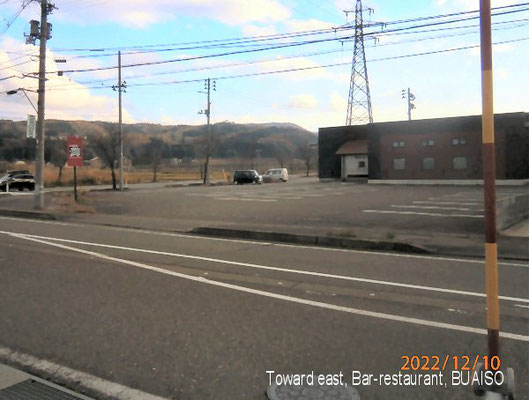
<0pa: 関川町の居酒屋、「武相荘(ぶあいそう)」東京方向、遠くは中央アルプス: Bar, “Buaiso” at Sekigawa-cho, toward east, Tokyo.>
<0pb:ご参考FYI: 武相荘:Buaisō. From Wikipedia>
👆
Description: “Buaisō (武相荘) is the former home of post-war Japanese bureaucrat Jirō Shirasu and his wife Masako Shirasu, located in Machida, Tokyo, to the west of downtown Tokyo. The name was derived from an amalgamation of kanji for the former provinces of Musashi and Sagami, as its location is near the border between the two provinces.”
👇
武相荘(ぶあいそう)とは、東京都町田市にある白洲次郎・正子夫妻の旧邸宅。 現在は「旧白洲邸・武相荘」として、記念館・資料館となり一般公開されている. 館長は白洲夫妻の長女・牧山桂子. 武相荘の名の由来は、白洲次郎のユーモアから「武蔵の国と相模の国の境に位置する」事と「無愛想」を掛けたもの.
(From ウィキペディア)
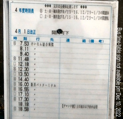
<0q: バス時刻表、『あ~、今日は土曜日、帰りのバスはない、急がなくては!』:Looking at this bus-time table at Sekigawa-cho. “Alas! As today is Saturday, there’s no buses for my coming back home! I have to hurry”>
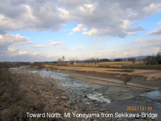
<0r: 関川橋より北方、佐渡島(見えないが)方向、これより西条地区:Toward north, Sado Islands (invisible) from Sekikawa Bridge; Nishijo District starts from here.>
<0s: 同上、米山(微かに見える)方向:Ditto, toward Mt. Yoneyama (a little, dimly [dímli] seen)>
<0t: 友人の池田理容店 (中央の家の1軒奥)、右は旧吉木小西側入り口に通じる通路、遠くの丘左奥に堂根神社がある(見えないが): Ikeda Barber shop, one of my friends, next to the house in the middle in this picture. The path (R) is to the west entrance of ex-Yoshiki Elementary School. There’s Dokon Shrine (invisible) in the hill afar.>
<0ua: 解体中の旧吉木小、かんずり前. 私の亡母の母校.:Ex-Yoshiki Elementary School being pulled down, my late mom’s mother school taken just from the front of Kanzuri Co. Ltd.>
<0ub: 同上 Ditto>
<0v:「水上村道路元標」(多分明治時代のものか): The stone monument, “Redistricted Sign of the road of Mizukami Village” (maybe from Meiji era.)>
<0w: 東方向、遠くに堂根神社の丘が見える; 西条と北条の境界付近より撮影:Toward east, Dokon Shrine is visible afar, taken from between Nishijo and Kitajo.>
<0x: 上越市板倉区に入る. 「吉増」地区、「県道30号」の標識:Itakura Ward, Joetsu City starts from here. The sign of “Yoshimasu” District + “Prefectural Road No-30” stands.>
<0y: 上越新幹線橋梁、右が長野方向、この辺から米増地区に.:“The bridge of Joetsu Shin-kansen, Right direction is Nagano. Yonemasu District starts from around here.”>
<0z: 熊川地区、右が妙高市上小沢地区へ続く農道: Kumagawa District starts from around here. The right farm-path runs to Kamikozawa District of Myoko City.>
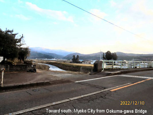
<0za: 大熊川橋:O-Kumagawa Bridge.>
<0zb: 大熊川橋より南方、妙高市南葉山北端を遠望:Viewing the northern edge of Mt. Namba Range in Myoko City taken from O-Kumagawa Bridge.>
<0zc: 針地区に入る. 市村鍼灸医院:Hari District starts from here; Ichimura Acupuncture Clinic.>
<0zd: 針地区入口、繁華街:The entrance of Hari District, downtown area.>
<0ze: 右、光が原高原へ:The right road runs to Hikarigahara Heights.>
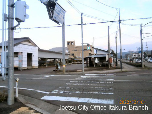
<0zf: 板倉支所 (光が原高原方向):Joetsu City Itakura Ward Branch Office. Taken toward Hikarigahara Heights.>
<0zg: 目的地、小林輪業. 新潟県立有恒高等学校はここより200m先右奥100mにある.:Goal, Kobayashi Bike shop. Niigata Prefectural Yuukou Senior High School stands 200 meters away from here turning right there.>
That’s it! Thanks, Mr. and Mrs. Kobayashi and my readers!